FLAIR : a Country-Scale Land Cover Semantic Segmentation Dataset From Multi-Source Optical Imagery
Abstract
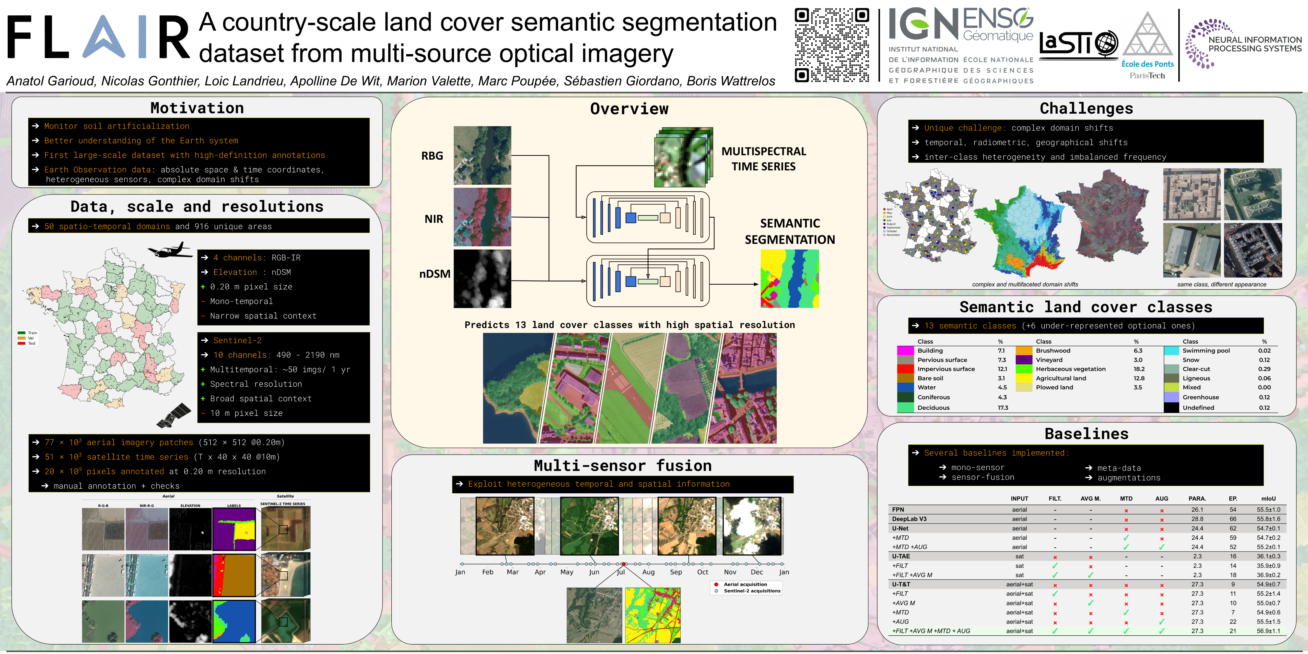
We introduce the French Land cover from Aerospace ImageRy (FLAIR), an extensive dataset from the French National Institute of Geographical and Forest Information (IGN) that provides a unique and rich resource for large-scale geospatial analysis. FLAIR contains high-resolution aerial imagery with a ground sample distance of 20 cm and over 20 billion individually labeled pixels for precise land-cover classification. The dataset also integrates temporal and spectral data from optical satellite time series. FLAIR thus combines data with varying spatial, spectral, and temporal resolutions across over 817 km² of acquisitions representing the full landscape diversity of France. This diversity makes FLAIR a valuable resource for the development and evaluation of novel methods for large-scale land-cover semantic segmentation and raises significant challenges in terms of computer vision, data fusion, and geospatial analysis. We also provide powerful uni- and multi-sensor baseline models that can be employed to assess algorithm's performance and for downstream applications.